
 EN
EN
 ar
ar bg
bg hr
hr cs
cs da
da nl
nl fi
fi fr
fr de
de el
el hi
hi it
it ko
ko no
no pl
pl pt
pt ro
ro ru
ru es
es sv
sv tl
tl iw
iw id
id lv
lv lt
lt sr
sr sk
sk sl
sl uk
uk vi
vi et
et hu
hu th
th tr
tr fa
fa ms
ms hy
hy ka
ka ur
ur bn
bn mn
mn ta
ta kk
kk uz
uz ku
ku
Digital Traversing Inclinometer
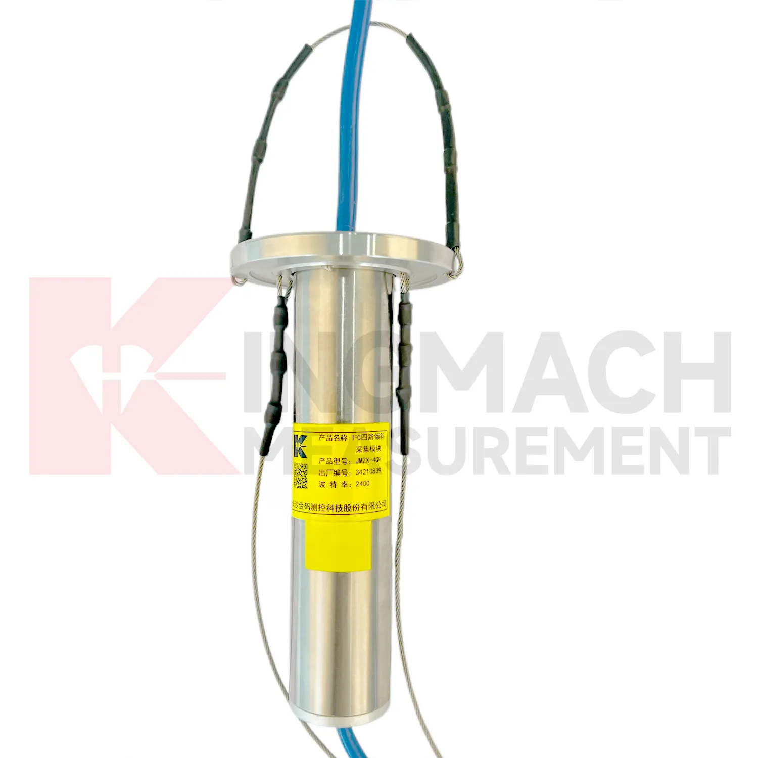
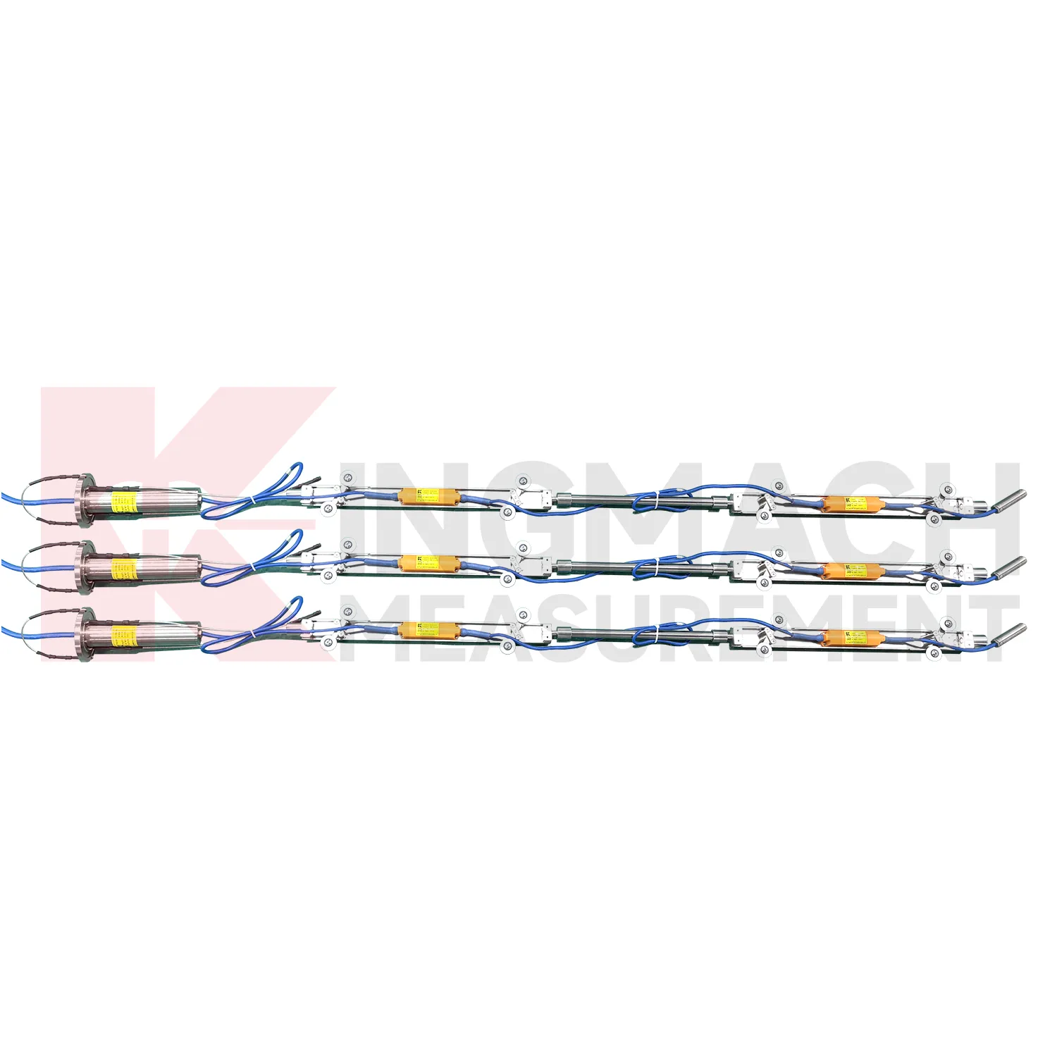
The JMZX-4QH acquisition module connects Kingmach Digital Traversing Inclinometer into a multi-channel inclinometer data chain. It is used to collect measurement data from multi-point vertical in-place inclinometer strings and upload the data by wired or wireless means. Product details describe one controllable sensor power supply output, four downstream communication interfaces, automatic recognition, intelligent calculation after connection, and installation at the inclinometer tube orifice for waterproof and dustproof protection. The module supports up to 100 sensors through four channels. Published data includes DC 9V to 24V operating voltage, standby power below 0.5W, operation power below 4W, RS485 uplink communication with configurable baud rates, -30 degrees Celsius to +70 degrees Celsius operating temperature, about 70 mm length, about 1 kg weight, and IP67 protection. It is relevant when borehole sensors need organized power, communication, and upload control.
Application of Digital Traversing Inclinometer
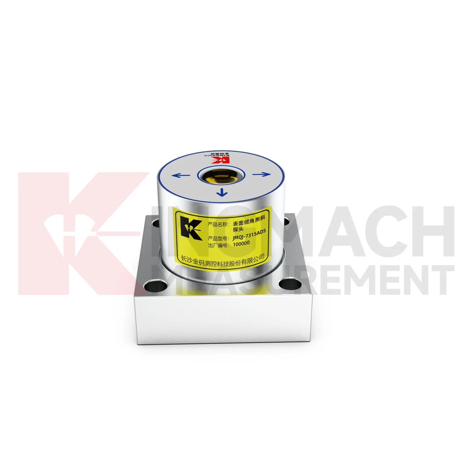
Foundation pit projects use Digital Traversing Inclinometer to monitor retaining wall rotation, support system response, adjacent building tilt, and deep ground movement during excavation. JMQJ-7315ADS can track angular change on exposed structures, while JMQJ-7915ATS can monitor multi-depth deformation inside a borehole. The excavation sequence, dewatering records, support installation dates, rainfall, and nearby settlement points should be reviewed beside the tilt data. If a retaining wall rotates while pore pressure or support force changes at the same time, the pattern deserves closer site checking. A practical layout marks the positive and negative axis direction before excavation begins, protects cables from machinery, and keeps baseline readings tied to excavation depth. This helps the monitoring team separate normal staged movement from a trend that may need immediate engineering review.
The future of Digital Traversing Inclinometer
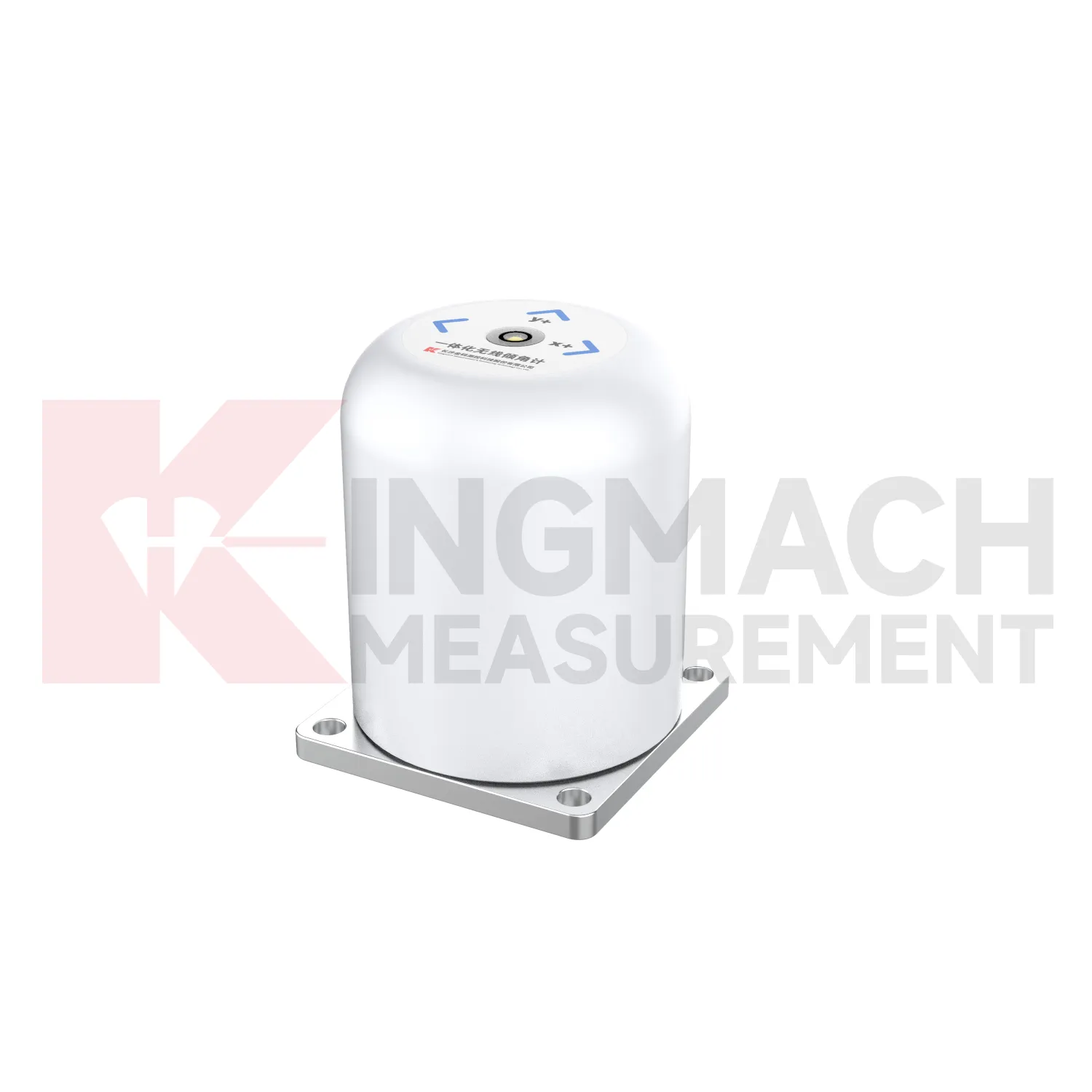
The future of Digital Traversing Inclinometer will be shaped by cleaner digital records. Tilt monitoring often continues after the construction team leaves, so a future-ready file should keep model, range, serial number, axis direction, baseline, mounting photograph, channel address, communication mode, battery record, and maintenance notes together. Kingmach products already include electronic codes, digital communication, 4G output, and acquisition modules that can support this direction. The next step is making those records easy to hand over from contractor to owner. A tilt curve without installation context can be difficult to interpret years later. A tilt curve with a clear instrument history can support inspection, maintenance planning, and engineering review across the full service life of the structure.
Care & Maintenance of Digital Traversing Inclinometer
Replacement of Digital Traversing Inclinometer should preserve measurement continuity. When changing a fixed tiltmeter, integrated wireless unit, in-place string component, acquisition module, or sliding inclinometer accessory, record model, serial number, range, old reading, new reading, reason, date, technician, and any change to axis direction or channel name. Do not hide the replacement by forcing the new curve to look continuous without explanation. If a borehole string is reconfigured, update depth mapping and group communication records. If a wireless unit is replaced, check battery, antenna, and upload timing. A clear replacement record lets future engineers understand the curve and prevents maintenance work from being mistaken for structural deformation.
Kingmach Digital Traversing Inclinometer
Kingmach Digital Traversing Inclinometer are useful when an engineering team needs tilt data that can be compared with displacement, settlement, strain, water level, or load readings. Tilt rarely stands alone. A retaining wall may rotate while a nearby displacement meter shows horizontal movement. A bridge bearing area may tilt as temperature and traffic change. A slope borehole may show deep lateral deformation before the ground surface opens. Kingmach JMQJ-7315ADS provides RS485 digital output for fixed tilt monitoring, and JMQJ-7315RTU provides 4G digital transmission for remote unattended work. These communication paths help put tilt data into a monitoring platform where engineers can compare time stamps and site events. The stronger the data chain, the easier it is to decide whether an angle change is structural behavior, installation disturbance, or a temporary environmental response.
FAQ
Q: How accurate is the JMQJ-7315ADS tiltmeter?
A: The product page lists 0.001 degree resolution and 0.01 degree accuracy for the +/-15 degree dual-axis model.Q: What protection grade does JMQJ-7315ADS have?
A: It is listed with IP68 waterproof protection and an operating environment from -30 degrees Celsius to +80 degrees Celsius.Q: What range does JMQJ-7315RTU provide?
A: The integrated wireless model lists +/-30 degree and +/-15 degree dual-axis range options, with 0.001 resolution.Q: How many sensors can JMZX-4QH support?
A: The module lists four channels and support for up to 100 sensors in a multi-point inclinometer system.Q: What is the guide wheel spacing for JMZX-7100L?
A: The sliding inclinometer page lists a 500 mm guide wheel spacing reference and a +/-90 degree sensor range.
Reviews
Joshua Clark
We ordered a full monitoring solution including sensors and data loggers. Everything works seamlessly together. Great supplier!
Christopher Martinez
Very satisfied with the readouts & data loggers. User-friendly interface and supports multiple sensor inputs.
Latest Inquiries
To protect the privacy of our buyers, only public service email domains like Gmail, Yahoo, and MSN will be displayed. Additionally, only a limited portion of the inquiry content will be shown.
Mia***@gmail.comNetherlands
Dear team, we are interested in your readouts & data loggers compatible with multiple sensors. Do yo...
Emma***@gmail.comCanada
Dear Sir/Madam, we are interested in displacement transducers and settlement sensors for a geotechni...